Maui, HI: Haleakala Summit & Lahaina (Day 4)

Haleakala's summit, Pu'u'ula'ula (which means red hill) is the highest point on Maui (10,023 ft elevation) and is also known as the East Maui Volcano which comprises 75% of the island.  This volcano is considered dormant, so it could erupt again at some point, but the last eruption is believed to have been in the 17th century.  The road to the summit was completed in 1935 and it is well maintained.  Since the temperature fluctuates a lot from the base to the summit, we brought a hoodie and a fleece for each person which worked well for us.  For this trip wear hiking shoes, long pants, and bring layers of clothing to keep warm if you want to spend time walking around.  Don't forget to pack food and water too.
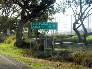
On the way
If you are able to wake up early, try to get to the summit to watch the sun rise.  We had hoped to do this, but our plans changed with the kids' needs.  In any case you need to get to the top earlier in the day because there are more clouds in the afternoon which won't let you enjoy the views.  The road is an ascending zig zag pattern resulting in 180 degree turns on an incline (I would describe it as steep and winding).  The Mazda was peppy and didn't struggle at all going up.  By the time we were driving up the mountain the sun was at an angle which made visibility an issue while driving up.  It was almost blinding when making these turns - add to that the vehicles and cyclists coming down.  As with most of the tourist routes, there are many scenic spots to pull over and snap a few photos.
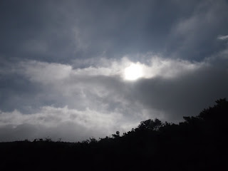
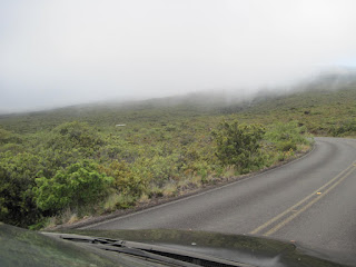
Every few miles there would be signs indicating the elevation.  The elevation change is very evident and you can feel it in your ears.  As you get further up the view is almost unbelievable and you start to approach the same elevation as the clouds.  Here, is where the weather becomes unpredictable, because the clouds appear like dense fog, mist and rain.  Visitors are cautioned to drive with headlights on, since the low lying clouds cause poor visibility.
The park headquarters Visitor Center


Once you get through the entrance gate, you can stop at the park headquarters to check conditions and take a few photos.  This serves as a good stop for snacks, washroom, etc. and to put on some warmer layers of clothing.  We spent a little bit of time here and then continued up to the summit.

The change in landscape was neat, as lush rainforest turned into lava rock, which turned to barren red rock and cinder cones as we reached the summit - reminiscent of the surface of Mars.  We pulled into the visitor centre and were thrilled to be looking down at clouds.  Then we continued to walk around the summit.
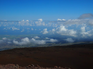
Above the clouds
Typically there are no concerns about altitude sickness at Haleakala, however, they recommend not running or overexerting yourself due to the thinner air.  We continuously monitored the kids for laboured breathing as well as temperature.  It is a bit colder up here too - when we started from the resort,  the temp was 72 deg. F. (22 deg. C), at the park headquarters it was 56 deg. F (13 deg. C), and at the summit it was 40 deg. F (4 deg. C).

Based on a friend's recommendation we also took a bag of chips with us, which inflated to almost pop the bag as we ascended.
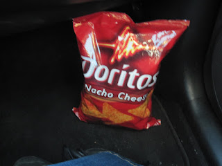
Before our ascent
at the top- it's ready to pop!

There are a few trails here which were a bit too long for us to tackle with the kids and reduced oxygen air.  If you are adventurous, visitors do have the option of overnight camping or using the cabins on the trails.  Some of these trails can take days to complete.

the trail map
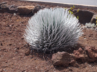
There are also a couple of short walking paths to guide you around Pu'u'ula'ula (the summit area) and to the observations deck.  These are very easy, but we had to make sure Evan kept away from the cliff edges.  There is also a little garden in the middle of the parking lot which lets you take a close look at the 'ahinahina (or Silversword) which is a rare and threatened plant species which grows on volcanic cinder.  The leaves have silver hairs on them which raises the plants temperature by up to 20 deg C, allowing it to survive at the high altitude.  You can also see the observatories for the summit, however, this area is not open to the public.
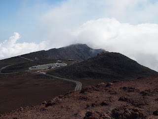
Haleakala Visitor Center 
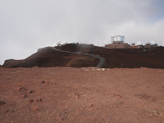
the Observatory in the distance


The Silversword, unique to high altitude ecosystems on volcanic cinder

When we were satisfied with all we'd seen, we started our drive back.  You do not need to touch the gas pedal on the drive down, but you do need to switch into low gear so you don't burn out your brakes.

In Kahului we found a Fabric Mart (pretty close to CR32 and the Hana Hwy. junction) which had Hawaiian and other fabrics at excellent prices. (hawaiifabricmart.com) I like to sew, so I couldn't help but pick up a few pieces.  We went back to the resort to enjoy some pool and beach time and then went on to explore Lahaina.

The Westin Maui offered a free shuttle into town (you have to pay for parking if you drive there yourself) and the most convenient stop for us was at the Hilo Hatties (they also have another stop at the shopping centre).  Walking around the town was really nice - the main strip is right beside the ocean and there are a multitude of shops catering to tourists and locals, as well as some excellent dining options.  There is a Whalers General Store in town as well as on the other islands, but one thing to note is that I wasn't able to find Macadamia Nut Liquer anywhere but Whalers General Store (on any island).
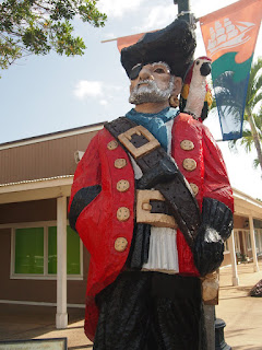

The Captain of Lahaina Center-one of a few larger than life statues greeting you at the Lahaina tourist area
 We took the opportunity to check out the Banyan Tree park, which is a giant banyan tree originally planted in 1873 by Owen William Smith to commemorate the 50th anniversary of Christian missionary work in Lahaina.  It is over 60ft tall and shades about 2/3 of an acre with 12 major trunks and a massive core.  It was imported from India and when originally planted, it was 8ft tall.  This is one of the largest Banyan trees in the world.  The park is quite busy, (which made it take some time to get a picture without other people in it.)


the busy park surrounding the banyan tree

The banyan tree
Lahaina has a small town atmosphere, but it is busy.  There are many outdoor events, music performances, patios, and art galleries to entertain everyone.  After exploring and picking up some souvenirs, we decided to dine at the Bubba Gump Shrimp Company which is chain of restaurants in Hawaii.
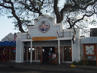
Where we ate dinner- at Bubba Gump's
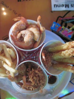
 I have to mention again, that customer service in Maui is beyond anything I have seen before, and at this restaurant they were very well coordinated - within seconds we were given a booth, a high chair was brought over, and our server took our drink requests.  Of course, everything in the restaurant was Forrest Gump themed.  The food was great and well priced.  Nigel and I ordered the Shrimp Lovers Heaven, which was yummy.  We picked the fish and chips from the kids menu for Evan, although by the end of it he was eating tartar sauce mixed with blue jello, eventually deciding he didn't like it.

one of the items decorating the restaurant

Shrimp Lovers Heaven
Kids menu- beverages & desserts 
Visiting Lahaina was a great way to spend our last evening in Maui.  Next, we had to pack for our flight to the Big Island of Hawaii the following day.

Maui, HI: the Pipiwai Trail and the Drive Back (Day 3 - Pt2)


There are a few picnic tables in the shade where you can enjoy your packed lunch against the scenic backdrop with a view of ocean.  After lunch we made sure we were fully stocked with food and water to tackle the long hike on the Pipiwai Trail to Waimoku Falls (4 miles roundtrip through the Kipahulu Valley).
Trail map
Waimoku falls is a dramatic 400ft waterfall down a flat lava rock wall to a rocky base.  The trail ascends 650 feet and is supposed to take 4 hours (roundtrip) to complete, although we moved a little slower with the kids.  Elliot (our 3 month old) was in the baby carrier strapped to mom, while dad carried all the gear and held Evan's hand (yes, Evan hiked this entire trail up and down without a problem while Elliot slept).  The good thing about this hike is that most of it has lot of shade and a nice breeze, but it is very hot initially.  We did run into people on the way who were heading back and some who were passing us - most seemed very intrigued by the fact that we had two little children with us (we didn't see any other small children).  We didn't realize why, until we were well into the rainforest - this wasn't an easy hike (although not difficult either), but it was long and we were burdened with all the extra baggage to carry - we didn't want to turn back after starting.  As you proceed through the trail you'll see many signs warning of you of the hazards.  


At the start of the trail you may notice some fallen fruit from a group of guava and mango trees there.  The sights were beautiful all along the trail, we passed our first landmark (Makahiku Falls) and then approached our second landmark (a large Banyan tree).  This spot made for some nice photos and a short break.
The large Banyan tree- truly a sight!
Further along the trail, there is a gate - not sure why, but you have to open it and then close it behind you with a bungee cord.  Most of the trail is made of rocky and uneven ground. Then, there are some more waterfalls and streams which are crossed by a couple of sturdy bridges.  Just after this scenic area you enter a bamboo forest.  Walking through the bamboo forest was a bit of a break, since most of this section is a level boardwalk.  It was also dark, and the breeze made the bamboo trees creak and knock together like an eerie drumming.  

Walking through the bamboo forest


Once you leave the bamboo forest, the trail gets a little tougher, very steep, narrow and rocky, with cliff ledges leading to the stream below.  There was also spot where the trail has eroded a bit and you have to tread on the remaining tree roots and rocks - still nothing we couldn't handle by being very careful.  Soon we could hear the sound of falling water and knew we were close to the end (very exciting).  After the next bend we saw a pretty big challenge: we had to cross a fast flowing stream and there was no bridge.  Some people were stepping on random rocks and balancing their way across, and the rocks were very slippery.

We could see the falls through the trees from where we were and contemplated not continuing, however, the next hikers behind us approached and asked if we needed help to get across.  I decided to stay behind with Elliot, while my husband carried Evan across with the help of another hiker.  His shoes and socks got soaked, but they made it across and continued to the next stream crossing where they admired Waimoku Falls and took some pictures to bring back to me.  While I was waiting for them to return, some more passing hikers offered me assistance; thinking for a minute that it would be nice to continue, I declined again, just in time to see one of them slip on a rock and fall into the stream (she looked like she was hurt, but not seriously - her friends helped her out and they continued up).  That was enough to make me not consider it again.  

One of the better places to cross the stream


While I waited, I fed the awake and by now hungry Elliot and got a few mosquito bites.  This was the only point of the hike where I might have wanted to be wearing bug repellant - it was probably due to the pooling water by the stream.  My husband, Nigel carried Evan back through the stream on his own, their clothes muddy and their shorts, socks and shoes wet - but the hike back would give them time to dry off.  The pics of the waterfall were amazing and people were swimming at the base of the falls.  Swimming at the waterfall is not recommended because of falling rock and there have been fatalities because of this (none during the time I was there though).  Even though I wasn't able to hike all the way to the falls area, it was still worth it to catch the glimpse that I did, and to experience the great sites along the way.

Waimoku Falls


When we got back to the car we started back through the highway to the Black Sand Beach at Waianapanapa State Park (near mile marker 32).  There are steps carved out of the lava rock, to get down to the beach, which was relatively quiet.  The park at the beach also contains a sea arch and a few short trails to explore some water caves and a blowhole.  The sand here could be easily packed together by hand and feels firm under your feet when walking.  Most of the beach area is more like pebbles rather than sand.  The waves are quite strong and I wouldn't recommend swimming, although people do it.  If you're lucky may spot some sea turtles, but we didn't.


Waianapanapa Black Sand Beach 


Some other neat stops along the drive are Wailua Falls at mile marker 45, Hana (and Hana Bay), Pua'a Ka'a State Wayside Park, 3 Bears Falls (near mile marker 19 & 20), and Keane Park (between mile markers 16 & 17).  Again, where you stop will be limited to the time you intend to spend at each area and if you plan on staying overnight in Hana itself.

The sun was pretty close to setting and we needed to drive a bit more aggressively to get onto safer road by the time it was completely dark.  It got pretty dark while we were on the Hana Highway, but we were lucky there was a local ahead of us sort of guiding the way.  By the time we got to some straighter road, it was completely dark, but it was more comfortable than the blind bends - we'd done the night drive to the resort once before.  It ended up being a late night by the time we got back and we had another early morning planned for the next day: the Summit of Haleakala and the town of Lahaina.

Maui, HI: Hana Highway and the Sacred Pools (Day 3 - Pt1)

We knew we wanted to explore the road to Hana - it's supposed to be one of the most scenic drives in the world, BUT take a look online and you'll find many describe it as being dangerous, tiring, and not recommended for those who aren't used to island/mountain driving.  The Road to Hana follows the coastline, has about 600 turns, and 54 bridges.  If that doesn't sound too bad, but most of the turns are blind, the roads are narrow, many sections are 1 lane (including bridges), there are no barriers on many of the cliffs, there's traffic and the views of the ocean, mountains, and waterfalls are very distracting - not to mention the weather is unpredictable and can change within minutes from rain to sunshine.

We looked at our options to compare the cost difference if we were to do a tour (on a tour bus) or to drive this ourselves.  At around US$120 per person a tour would cost close to US$500 (there's a charge for kids too) and most companies will provide food and refreshments.  Pickup locations are all in the Kahului area which is the main tourist/hotel area (closest to the bigger airport) and 30-45 minutes away from Ka'anapali where we were staying.  So, parking needed to be a consideration as well as the stops on the tour.  Tours will typically take you all the way around the east side of the island which you won't be able to do with most rental cars, since rental contracts typically prohibit going past the Oheo Gulch (also known as the Seven Sacred Pools on CR31) if coming from the north side.  A few locals told us that although these contracts exist, the road is paved and everyone drives all the way around - I prefer not voiding the rental agreement.

We ultimately decided to drive ourselves in the SUV, so that we could pick the spots where we wanted to stop and because there wasn't anything past the Oheo Gulch that we really wanted to see.  Our plan was to drive to the Oheo Gulch and make stops along the way back.  This would help us make a quick exit to the hotel during sunset since we didn't want to drive this route once it got dark.  The other benefit is that we would be way ahead of the crowd and would then miss them on the way back.  Wear hiking shoes, bring extra clothes, pack food and water, and go with a full tank of gas for the trip, as this ends up being a very remote location.

We tried to stick to our plan which would take a little over 3 hours to reach the end, but couldn't help ourselves and just had to stop at some of the scenic points.  There are many areas where there's a little bit more space to pull over your vehicle and take some great pics, and these can also be used to let the locals pass, at amazingly more than double the speed limit.

Along the Hana Highway


Here's a short video (about 5 min) with clips from our drive - it might give you motion sickness from the jerky camera footage.  It gives you an idea of the road, if you want to try it.


Once we past Hana the road signs weren't the best and we thought that we might be on the wrong road.  There wasn't as much traffic any more and the road was quite a bit rougher and reduced to one lane - whenever another vehicle approached, we both drove very slowly and partially on the grass/rock shoulder, making sure we didn't roll into the ditch.  We decided to keep going for the sake of adventure, but it turned out that we were on the right track, evidenced by our approach to the Seven Pools.  As you drive towards the turn for the park entrance, you have to honk as you come down the hill because there is zero visibility in both directions.  If you've driven in the country and are a confident driver, you can do this yourself and save some money over going with a tour company.  There are some uncertain turns, since you can't tell if anything (big or small) is coming around the bend, but drive defensively and you should be fine.  Overall, I think the scariness factor of this drive has been over exaggerated by the online community - just drive defensively, however, if you aren't a confident driver, then don't attempt it.

We entered into Haleakala National Park at the Kapahulu area, near mile marker 42 and paid the US$10 entrance fee which was valid for 7 days and would allow us to also enter the park from the other side to go to the summit of Haleakala.  Once parked, we took a quick look in the visitor centre to check the hiking conditions and then proceeded to do the shorter hike around the pools before we had lunch.  For all the parks you go to, you should stop at the visitor centre to check conditions - weather is unpredictable and rain can cause flash flooding in the area.
 This hike was a 1/2 mile loop and very easy.  Evan (our 3 year old) hiked this no problem and we even ventured to the water flows and the pool.  Although we didn't have any issues or accidents, the lava rock is very slippery when it's wet, because its composition has a high proportion of glass.  The heavy rains which occur on this side of Haleakala are caused by the condensation of clouds in the cold air against the mountainside, and carved the pools, channels and waterfalls visible today.  


The cascading waterfalls/pools flow into the ocean which is very neat to see.  Rainfall averages more than 300 inches per year and is one of the wettest places on earth.  A fun fact is that less than 10 miles away in the rain shadow of the mountain, the average rainfall is less than 30 inches per year.  It is also a unique ecosystem for rare species of snails (Hihiwai), shrimp (Opai), and a migratory fish (Oopu).  We finished this trail in about an hour, which includes all our stopping, exploring, and pictures.

Stay tuned for part 2: the Pipiwai Trail and driving the road back